Community led research to tackle road safety and pollution
 Air pollution in Greater Manchester
Outdoor air pollution contributes to millions of deaths every year, worsens conditions that affect the lungs, heart and infections such as COVID-19 and influenza. The impact of pollution on health is unequal and the elderly, the very young, those with pre-existing health conditions, and people in lower income neighbourhoods are much worse affected.
Greater Manchester (GM) has amongst the worst levels of pollution in the UK. Ardwick is a central area of Manchester which is bordered by busy major roads. Residents there are concerned about the impact of pollution on their health and, particularly, their children’s health. They are also very worried about road safety and how difficult the neighbourhood is to navigate. The University has been working in Ardwick in partnership with local residents and Ardwick Climate Action to explore these issues and what can be done to address them.
Harnessing the knowledge of community hubs
Our collaboration revealed hotspots in Ardwick for fast-moving, dense traffic and poorly lit paths. Although busy roads were heavily used by pedestrians, particularly children on the school route, they were felt to be dangerous, as one resident highlighted: “Cars come flying off the roundabout, cars don’t stop.”
People also commented how it could take 15 minutes or more for a gap in the traffic to enable them to cross the roads safely.
Hyper-local pollution monitoring
All this information has been recorded and collated into a map. This information collected was used to inform targeted pollution monitoring which revealed extremely high levels of pollution on the main commuter roads. Quieter roads and green spaces had significantly lower pollution levels. This was most notable at the school entrance points next to the main road (the A6), which had significantly higher levels of pollution than the entrance on the residential road. Our research had shown that currently many children used this busy polluted road, potentially getting much higher exposures to toxic pollutants than they would have if they used quieter residential routes.
A greener walking route
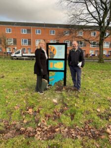
The data collected was used to create a greener walking route. The route takes in much of the planting that has been done by Ardwick Climate Action, has much lower levels of pollution and avoids many of the busy dangerous routes. Artist, Sally Gilford, was commissioned to create wayfinders in the community to indicate the walking route for residents. The routes have QR codes linking to information about the plants, the Universirty research and local information.
By partnering with the community, the project has been able to highlight particular areas that may require urgent safety interventions, and we hope this will enable targeted action. It has been inspiring to work with the community so closely and we hope the walkway will be enjoyed for many years to come.
